Historic Cities · Netherlands
Saeftinghe through the ages
Saeftinghe or Saaftinge was a town in the southwest Netherlands, located in eastern Zeelandic Flanders, near Nieuw-Namen. It existed until 1584. It is now a swamp known as the Drowned Land of Saeftinghe and an official nature reserve area. The land is a crosspoint where the river Scheldt meets the salty waters of the North Sea in the estuary Western Scheldt.

Saeftinghe in 1570
The Rich Polder Town
Saeftinghe in 1570 is a prosperous polder community where fertile fields and busy quays meet the tidal Scheldt on the edge of the sea. This walk follows the dyke-line, the windmill and the village streets to the church tower, the peat moors and the barges, and pauses at a local place of legend where a captured mermaid is said to have cursed the land.
Low horizons, red-brown brick and pale thatch, and long straight drainage channels define Saeftinghe in 1570. The skyline is a compact ribbon of church tower and the crenellated Saeftingher Slot, set against reedbeds and the wide, tidal Western Scheldt. Earth and clay dykes capped with grass, wooden sluices and a scatter of timber farmhouses shape a humanised marshland of small scale, salt-tinted light and a wind that carries gulls and trade dust from the estuary.
The route: 10 streets, squares and views
Western Scheldt Approach → Saeftinghe Sea Dyke → Polder Windmill → Lower Polder Wheat Fields → Saeftingher Slot → Village Quay → Peat Moors → Church Tower of Saeftinghe → Mermaid's Dyke → Upper Dyke Lookout
Step inside, 5 interiors
Mill Floor and Gearing · Polder Farmhouse Kitchen · Great Hall of Saeftingher Slot · Parish Church Nave · Dyke-Warden's Watch Room
Planned from the Wikipedia record: Saeftinghe.
Its story
The story of Saeftinghe.
Chavetinghe, 821, and the Ter Doest Polder
The name is first recorded in 821, in the form Chavetinghe, as a holding of King Louis the Pious. What made the place worth holding was also what would eventually destroy it: it sat in eastern Zeelandic Flanders at the point where the Scheldt meets the salt water of the North Sea, on ground that had to be taken from the tide before anyone could farm it.
That work was done in the thirteenth century, when the land was drained and diked under the management of the abbey of Ter Doest. Willem van Saeftinghe, one of the best known of the abbey's occupants, gave his name to the stretch of land claimed from the sea. His personal shield is the source of the flag still associated with the place, a blue lion rampant on a white field.
Fertile Polder, Peat Salt and the Count's Castle
The reclaimed ground was very fertile polder, and Saeftinghe made its living from farming it, from trade, and from moernering, the digging and burning of peat to win sea salt. Agriculture and salt together brought work and money, and the town became one of the most prosperous places in the region. Its polder was at its greatest extent and wealth around 1350.
It did not stand alone. Namen, Sint-Laureins, Stampaert, Weele (also called Sint-Marie), and Casuwele lay nearby, most of them small villages of a few houses and huts. At the end of the thirteenth century and the beginning of the fourteenth, Saeftinghe passed for some decades to the count of Flanders, who built a castle not far from the settlement (the Saeftingher Slot, dated to 1279), both because the site commanded the division of the Scheldt and the Honte and to make his power visible on it.
The All Saints' Flood, 1570
The polder held until 1570, when the All Saints' flood, the Allerheiligenvloed, took most of the land around the town. Four years later the drowned ground reached as far as what is now Belgium. Saeftinghe itself and some land immediately around it were all that stayed dry.
The Last Dike Cut, 1584, and What Was Never Won Back
In 1584, during the Eighty Years' War, Dutch soldiers found themselves forced to destroy the last intact dike, and Saeftinghe sank into the waters of the Scheldt. The town has never been retrieved. Everything that stood there lies under several layers of clay and sand, and large bricks turned up inland are probably remains of the abbey, reused by villagers for their own houses after floods destroyed it; some are now shown in the visitor centre.
Reclamation was attempted repeatedly over the following centuries. The most serious effort came in 1907, and even that won back only the Hertogin Hedwigepolder, on which the hamlet of Emmadorp now stands. The rest remained what it is today: a tidal marsh where the water can take large stretches of ground in seconds, and which is not to be walked without an experienced guide.
The Mermaid, the Bell and the Fog
A legend of Saeftinghe explains the flood as a punishment. It holds that a mermaid was caught and not set free, that the merman cursed the region for it, and that the resulting flood destroyed Sint-Laureins, Namen and Casuwele and killed everyone in them. The same tradition says a tower bell still calls for help from the sunken town. A second local legend accounts for figures seen in the fog by visitors and by people from Emmadorp as the spirits of the inhabitants of those three drowned villages.
Hulst, 1970, and the Drowned Land Today
In 1970 the whole area was absorbed into the municipality of Hulst, when Graauw en Langendam and Clinge ceased to exist. Within the historical municipal limits Saeftinghe has a population of 55. The marsh is an official nature reserve, known in Dutch as the Verdronken Land van Saeftinghe, in the province of Zeeland, and the town beneath it is now classed as a submerged settlement. A visitor centre opened at Emmadorp in 1997 as the departure point for excursions into the reserve, and between 1997 and 2007 an average of around 12,000 people a year took one.
From the archive
Saeftinghe on paper: the place as it was mapped.
A period map that sets the place down, drawn between 1500 and 1850, the ground this page's reconstructions walk. Public domain, with its source named.
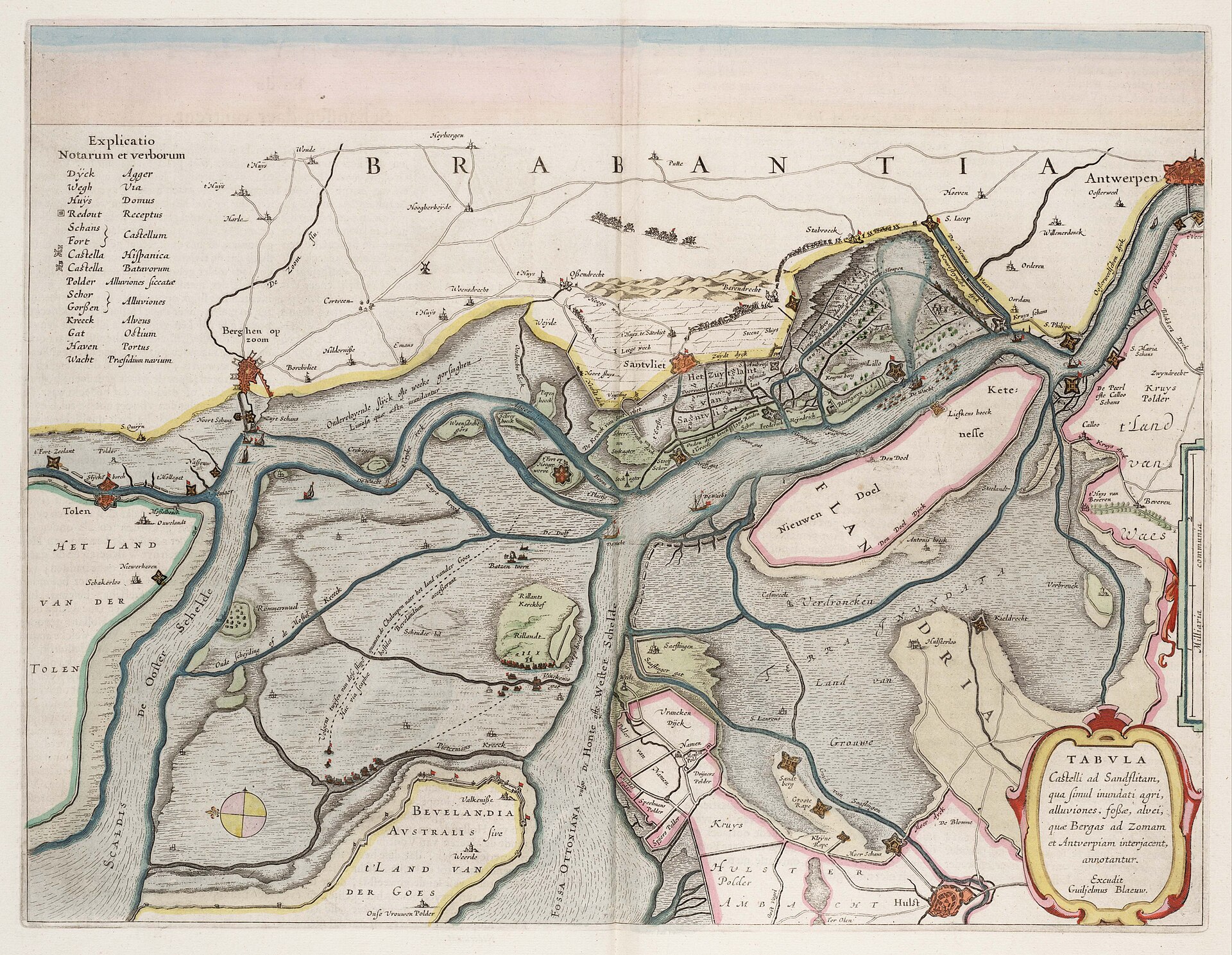
Tabula Castelli ad Sandflitam: Blaeu's map of the drowned Scheldt polders
Saeftingen and its Verdroncken Land lie between the Scheldt channels, ringed by the forts, dykes and sunken polders left after the land was let go to the sea.
1664 · Joan Blaeu · Wikimedia Commons
Public domain (plate dated 1664)
More cities to explore
 BelgiumAntwerpExplore it in 1560 · 1910
 BelgiumGhentExplore it in 1350 · 1913
 NetherlandsAmsterdamExplore it in 1550 · 1660 · 1890
 NetherlandsUtrechtExplore it in 1400 · 1700
Castles of Europe · Landmarks of Europe · create your own reconstruction.