Historic Cities · Belgium
Brussels through the ages
The City of Brussels is the largest municipality and historical centre of the Brussels-Capital Region, as well as the capital of the French Community of Belgium, the Flemish Region, and Belgium. The City of Brussels is also the administrative centre of the European Union, as it hosts a number of principal EU institutions in its European Quarter.

Brussels in 1560
Bruegel's Brussels
Brussels in 1560 is a compact, fortified capital where ducal power on the Coudenberg and the civic guilds of the Grand-Place shape daily life. This walk traces the approach across fields and the city gates, moves through market streets and the Senne's mills and breweries, and descends into the Marolles where kermesses and street processions animate the lanes.
The skyline is a serried ridge of steep slate and tile roofs punctured by the Town Hall's Gothic tower, the mass of the Coudenberg palace and church spires; stone and dark-stained timber dominate façades, stepped gables and carved cornices catch paint and limewash, and narrow cobbled streets channel smoke, cart-wheels and voices. Along the Senne low quays, wooden bridges and watermills give the lower town a working, damp character, while banners and guild colours enliven the squares.
The route: 22 streets, squares and views
Sonian Forest Edge → Halle Gate (Porte de Hal) → Rue Haute → Kiekenmarkt (Chicken Market) → Senne Mills and Breweries → Place Saint-Géry → Grand-Place → Town Hall (Stadhuis) → King's House (Broodhuis) → Grasmarkt (Herbs Market) → …
Step inside, 12 interiors
Brewhouse of the Senne Mills · Fishmongers' Covered Hall · Clothiers' Guildhall · Gothic Council Hall · Breadhouse Grain Hall · Saint Nicholas Nave · Aula Magna of Coudenberg · Beguinage Refectory · Merchant's Counting House · Drapers' Workshop Loft · Pieter Bruegel's Workshop · Tavern Hall at the Kermesse
Planned from the Wikipedia record: History of Brussels.
Brussels in 1700
Rebuilt Grand-Place
Five years after the 1695 French bombardment, Brussels’s central square has been raised again by the city’s guilds into a coherent baroque ensemble trimmed with gilt. The walk moves from the approach through market streets and river quays to the newly restored Grand-Place, its intact town‑hall spire, and the working tapestry and lace workshops that are returning the city’s trade.
The centre is a broad paved rectangle about 68 by 110 metres, ringed by new guild façades in flamboyant baroque, pale limestone and plaster, their cornices and statuary highlighted with burnished gilt. The stone shell of the Gothic town hall and its soaring spire remain the dominant vertical, while lower narrow streets funnel carts and pedestrians toward the square. Roofs are steep and dark, chimneys rise in clusters, and the air carries wool dust, tallow smoke and river mist from the Senne.
The route: 20 streets, squares and views
Halle Gate (Porte de Hal) → Rue Haute → Place Sainte-Géry → Senne Quays → Plattesteen → Rue de la Tête d'Or → Rue des Bouchers → Rue au Beurre → Cantersteen → Rue du Marché aux Herbes → …
Step inside, 13 interiors
Tapestry Workshop Loft · Shipchandler's Loft and Sail-room · Meat Market Great Hall · Lace Merchant's Showroom · Drapers' Guild Council Chamber · Goldsmiths' Ornamental Hall · Town Hall Spire Stair · Brewers' Guild Great Hall · Inn Parlour of the Pigeon · Breadhouse Accounting Hall · Hatters' Workshop and Showbench · Cloth Hall Under-Roof · Coudenberg Palace Antechamber
Planned from the Wikipedia record: Grand-Place.
Brussels in 1900
Art Nouveau Brussels
At the turn of the century Brussels is a capital remaking itself in stone, iron and glass, where Victor Horta's new Art Nouveau houses and public works by King Leopold II stand beside older guild façades and covered arcades. This walk follows the city from its southern station through the old market quarter, the glazed galleries and fashionable avenues to big civic promenades and a high legal esplanade.
Brussels in 1900 is a low, densely built capital punctuated by the sinuous iron and glass of new buildings, the neat chestnut-lined boulevards of Leopold II's projects and the dark mass of older Gothic and Baroque roofs. Shopfronts and covered galleries glitter with plate glass; tramlines and horse-drawn traffic thread broad boulevards; façades display stone, cast iron and polished exotic woods. Light favours skylights and glass canopies, and the city reads as a palette of soot-dark roofs, pale stone and gilt detail.
The route: 21 streets, squares and views
Gare du Midi Forecourt → Porte de Hal (Halle Gate) → Rue Haute → Grand-Place → Galeries Royales Saint-Hubert → Rue Neuve → Manneken Pis → Place de la Monnaie → Boulevard Anspach → Place de Brouckère → …
Step inside, 12 interiors
Principal Waiting Hall · Gothic Council Hall · Luminous Covered Arcade · Opera Auditorium · Gilded Café Salon · Triumphal Arcade Gallery · Main Marble Staircase · Central Stairwell · Studio Atrium and Stair · Iron Assembly Hall · Sales Gallery Atrium · Domed Rotunda and Steps
Planned from the Wikipedia record: Victor Horta.
Its story
The story of Brussels.
Bruocsella: From Marsh Chapel to Grain Port, 580-1200
The first known inhabitants of the area kept to the edges of the region and avoided the marshy valley of the Senne. Roman villas stood on both banks in the 1st and 2nd centuries CE, and by the 4th to 6th centuries Frankish tribes held the land between the Meuse and the Scheldt, leaving a Merovingian cemetery of more than three hundred graves at Anderlecht. The name of the place is Frankish: bruoc and sella, the settlement by the marsh. In 580 Saint Gaugericus built a chapel on an island in the Senne, the origin point of the settlement that became Brussels. The region passed to Lotharingia under the Treaty of Verdun in 843, the County of Brussels was first mentioned in the Treaty of Meerssen in 870, and by 959 the territory formed part of Lower Lotharingia.
A castrum was raised on Saint Gaugericus Island between 977 and 979, and in 979 Charles, Duke of Lower Lorraine, moved the relics of Saint Gudula to Gaugericus's chapel, an act long treated as the city's official founding. Current research puts the emphasis elsewhere: Brussels appears to have grown gradually out of an agricultural community that expanded rapidly from the 8th century, and the castrum narrative rests on later and less reliable sources. The first reliable mention, from around 1015-1020, describes a portus, a loading and unloading place on the Senne, and that is what the town did for a living before it did anything else. Local farmers were obliged to bring their grain to Brussels for shipment, and a north-south road tied the port to the grain country of southern Brabant and Hainaut while feeding the east-west traffic between Flanders and the Rhineland. Within the town that road became the Steenweg. Princely authority followed the trade: the Counts of Leuven established a presence soon after, drawn by the vitality of the port and the countryside around it.
For two centuries Brussels was less a town than a loose cluster of settlement cores, a pattern described as polynuclear: the portus, the Coudenberg lordship, the ground around Saint Michael's Church where a chapter of secular canons was founded in the mid-11th century, and a textile district laid out in the early 12th century around the Chapel Church, in what is now the Marollen. Competition between these cores turned a group of villages into a single urban body, and fixed a division still legible in the city: trade and municipal authority in the valley, princely residence on the hills above it.
Capital of Brabant: Charter, Cloth and Revolt, 1209-1406
Early in the 13th century the town won financial independence through a revenue account and received a charter of rights in the same year, and under Duke John the Victorious it became the capital of the Duchy of Brabant. Its administration grew around cloth: a Drapery Court, a Wise Council, formal recognition of the cloth guild, restrictions on artisans, and duties levied on the cranes and on beer. The surrounding villages of Schaerbeek, Etterbeek, Laeken, Anderlecht, Obbrussel and Forest were drawn into the Coop of Brussels, Molenbeek having joined earlier.
The 14th century brought famine, plague and open conflict. The city lived through the Great Famine and the Black Death; craft uprisings, the Brussels Revolt and the suppression of the craftsmen that followed it, and the Battle of Scheut all fell within the same span. The Seven Noble Houses were attested as the governing patriciate, while the guilds of Saint Luke, the Four Crowned and the Brewers won recognition. Everard t'Serclaes liberated the city in 1356; he was mutilated and died in 1388, and the city sent a military expedition against Gaasbeek Castle in reprisal. Geert Pipenpoy became the first mayor in 1380, the Halle Gate went up, work began on the Town Hall and a Court of Auditors was established. The population stood at around 20,000 by 1400, in spite of destructive fires in 1405 and 1406.
Burgundian and Habsburg Court City, 1406-1556
Conflict between Duke John IV and the States of Brabant ended in 1421 with the guilds admitted to city government alongside the Seven Noble Houses. In 1430 the city passed into the Burgundian State under Philip the Good. Rogier van der Weyden was appointed city artist, the Town Hall was completed, and printing presses and chambers of rhetoric were established. Under Charles the Bold and the Habsburgs the Chamber of Accounts was moved out to Mechelen; Duchess Mary of Burgundy granted the Great Privilege, restoring liberties to the city and to the States General.
Under Emperor Charles V, Brussels became the official capital of the Netherlands and held the permanent court. Postal services were established, the King's House and the Granvelle Palace were built, and the Willebroek Canal was cut. The city codified its liberties and reformed poor relief through the Supreme Charity; Erasmus and Andreas Vesalius were among those associated with it. The same decades saw Lutheran, Munsterite and Mennonite communities form in the city, and people executed for heresy.
The Dutch Revolt and the Bombardment of 1695
Under Spanish rule from 1556 Brussels sat at the centre of the Dutch Revolt. The Petition of the Nobles, the iconoclastic attacks and then the arrival of the Duke of Alba ran through the city, and the Counts of Egmont and Horn were executed there. Government alternated between periods of Calvinist rule, including the Calvinist Republic of Brussels, and Spanish military control, which included a siege by the Army of Flanders. Alongside the Amigo Prison came witch trials and further executions for heresy, among them Josyne van Beethoven. Plague struck in 1575 and again in 1634.
The heaviest blow was the French bombardment of 1695. The city rebuilt the Grand-Place afterwards, and the closing decades of Spanish rule brought the Theatre of La Monnaie and the Royal Academy of Fine Arts, along with colleges, convents and charitable foundations.
Austrian Rule, the Brabant Revolution and the Department of the Dyle, 1719-1800
François Anneessens was executed on the Grand-Place in September 1719; the Senne flooded in March 1724 and left the lower town under water; the Palace of Coudenberg burned down in February 1731. French forces besieged and took the city in early 1746 during the War of the Austrian Succession, and it went back to Austria under the Treaty of Aix-la-Chapelle in 1749. In the decades that followed, Brussels Park, the Rue Royale and the Place Royale were laid out, and the Palace of the Council of Brabant, the Royal Palace and the Palace of Laeken were built.
Emperor Joseph II's reforms, which dismantled the city's fortifications and abolished provincial privileges, met resistance. Street fighting with Austrian troops in 1787 and 1788 helped set off the Brabant Revolution, and Brussels briefly served as capital of the United Belgian States before the Austrians recovered control. French troops occupied the city in 1792, lost it, and took it back in 1794 after the Battle of Fleurus. In 1795 Brussels was formally annexed by France and made capital of the department of the Dyle. French administration suppressed the guilds and the abbeys, demolished churches and secularised the street names, while introducing a civil registry and a central school for the department. By 1800 the city counted more than 66,000 inhabitants.
Capital of Belgium and the Shape of the Municipality
The Belgian Revolution of 1830 broke out at the Theatre of La Monnaie and ended in independence, with Brussels as the capital. The new upper class wanted a prestigious residential quarter to match, and an official plan for the Leopold Quarter was drawn up in 1838, the city's first major eastward extension, on land transferred from the municipality of Saint-Josse-ten-Noode. In 1844 the Avenue Louise was proposed as a monumental avenue running from the centre out to the Bois de la Cambre. Saint-Gilles and Ixelles, through whose territory it would pass, fought the scheme hard, and after years of fruitless negotiation the City of Brussels annexed the strip of land it needed, together with the Bois de la Cambre, in April 1864 - which is why the municipality has the shape it does and why Ixelles is split in two.
The city bought half of Saint-Josse in 1853, after that municipality's administration went bankrupt; that ground is now the Squares Quarter. In 1880 a former military exercise ground in Etterbeek and the land around it were attached to create the Parc du Cinquantenaire, an exhibition space for the fiftieth anniversary of independence. The largest single extension came in 1921 with the annexation of Haren, Laeken and Neder-Over-Heembeek to the north. When Belgium merged its municipalities wholesale in 1964, 1970 and 1975, those of the Brussels-Capital Region were left alone, so the boundaries drawn in the 19th century and in 1921 still stand.
European Quarter, Two Languages and a City of Arrivals
Brussels held the World Exhibition of 1935 and the World's Fair of 1958, which left the Atomium behind. It is the capital of Belgium, of the French Community, the Flemish Community and the Flemish Region, and the administrative centre of the European Union: the European Parliament meets mainly here, and the European Commission, the Council of the European Union and numerous agencies sit in the Leopold Quarter. NATO's headquarters and Eurocontrol are at Haren, one of the districts annexed in 1921. On 1 January 1983 the Brussels liberals lost the mayoralty they had held since before Belgian independence, and a socialist took the office for the first time; Philippe Close of the PS became mayor in June 2017, after the sp.a left the governing coalition over irregularities involving the then mayor, Yvan Mayeur, and the homeless services organisation Samusocial.
The municipality had 196,828 inhabitants on 1 January 2024 across 33.09 square kilometres, and 75,998 registered non-Belgians in 2023. Counted by the nationality of birth of a resident's parents, in 2023 some 55.84 per cent of the population was of non-European origin, predominantly Moroccan, Indian and Congolese, 27.21 per cent of European origin other than Belgian, mainly French, Romanian, Italian, Spanish and Polish, and 16.94 per cent solely of Belgian ancestry; among the major non-EU groups most permanent residents have taken Belgian nationality. The city is officially bilingual in French and Dutch, though most inhabitants, commuters and long-term foreign residents use French day to day. The old Brussels speech is a Brabantian dialect grown out of the local Middle Dutch and heavy with French loanwords; a native born in the city to two Brussels parents is called a Ketje, one with a single such parent a Zinneke.
From the archive
Brussels on paper: the old town as it was mapped.
A period plan or bird's-eye view of the old town, drawn between 1500 and 1850, the streets this page's reconstructions walk. Public domain, with its source named.
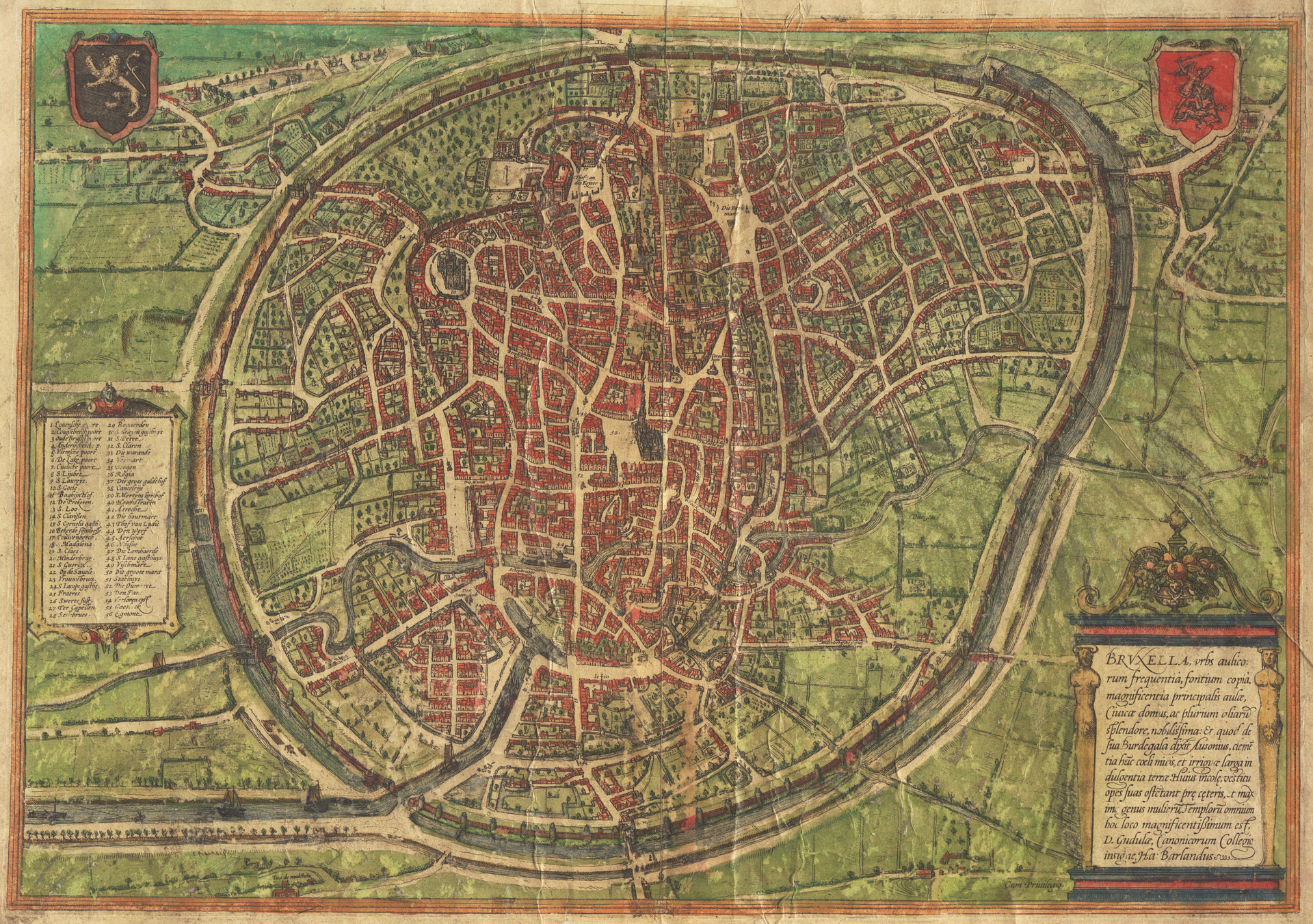
Bird's-eye view of Brussels, from Braun & Hogenberg's Civitates Orbis Terrarum (1572)
Walled medieval Brussels showing ramparts and moat, gates and bridges, dense street network, market square and multiple church spires by the river.
1572 · Georg Braun / Frans Hogenberg · Wikimedia Commons
Public domain (plate dated 1572)
In this city
Landmarks of Brussels, see each in its prime

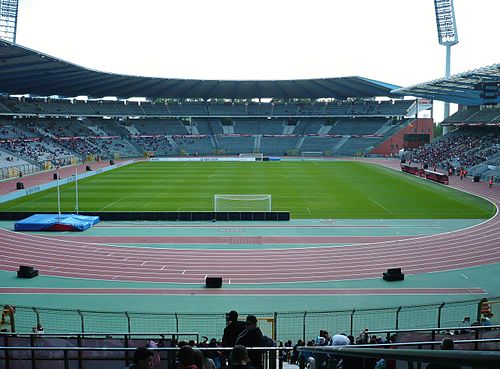


Castles of Brussels


More cities to explore
 BelgiumLeuvenExplore it in 1470
 BelgiumAntwerpExplore it in 1560 · 1910
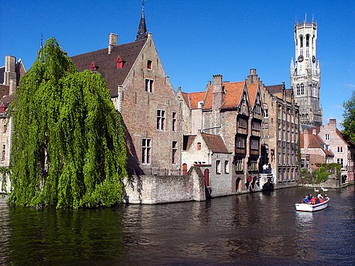 BelgiumBrugesExplore it in 1300 · 1440 · 1895
 BelgiumGhentExplore it in 1350 · 1913
Castles of Europe · Landmarks of Europe · create your own reconstruction.